The beginning and the end of the Paleozoic Era are well defined by major breaks, or tipping points, in the history of life on Earth. The Era began around 540 million years ago with the “Cambrian Explosion”: the dramatic first appearance of abundant fossil remains in sedimentary strata worldwide. The Era ended nearly 300 million years later with the greatest mass extinction event in the history of life on earth. But the subdivisions of the Paleozoic (known as Periods) are not so well defined. They reflect history of geology as much as they do geological history.
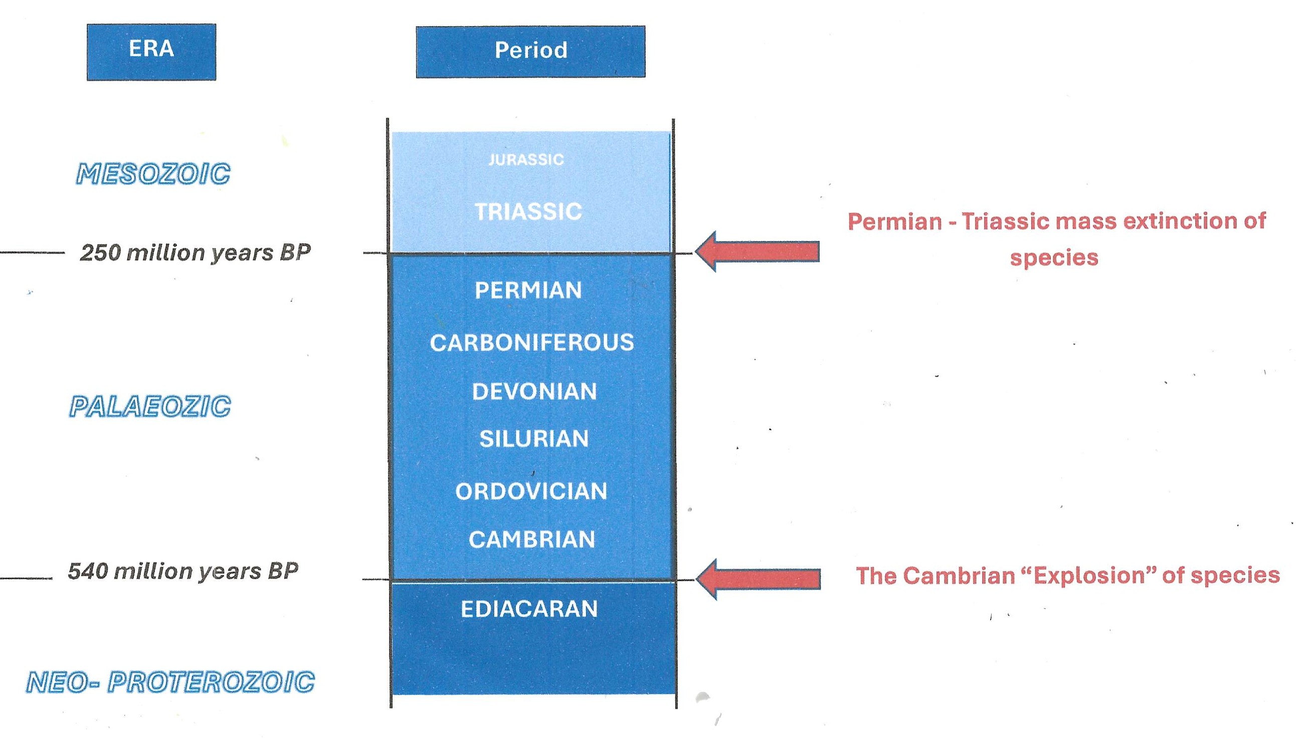
The sub-divisions of the Paleozoic. Click for a sharper image.
The science of geology was born in the last few decades of the 18th and the first few decades of the 19th centuries. It was a time of rapidly advancing scientific knowledge. In the embryonic science of geology new knowledge was driven by progressive improvement in geological method, and in particular a way of proceeding through the production of ever more refined geological maps. During this time the great geological Periods – the Primary the Secondary and the Tertiary were defined and named by the pioneer geological theorist Charles Lyell. These primary divisions remain today, although the Primary and Secondary of Lyell are now known by their modern names of Paleozoic and Mesozoic, and the Tertiary has been downgraded to a Series called the Paleocene and subsumed into the Cainozoic.
In the 50-year period from 1830 to 1880 the subdivisions of the Paleozoic were established and named by the giants of early field geologists through heroic campaigns of field work, geological mapping, controversy and compromise. It is an oft told and fascinating story.
But one more re-telling can do no harm.
The 18th century practitioners of geology were moneyed gentlemen with time on their hands who introspected from the comfort of their living rooms and made wide ranging deductions from specimens of rocks, minerals and fossils. These they bought from quarrymen or commercial collectors to fill their cabinets of curiosities. As gentlemen, did not do field work, or where they did, it was occasional and limited jaunts out of London.
In England the way forward was shown by William “strata” Smith, no gentleman but the son of a blacksmith and a self-taught land surveyor. Smith was very much the field man who, self- funded and self-taught, travelled the roads of England for over 20 years in order to publish, in 1815, his great map of the geology of England. This was the first geological map in the world of such a scope and ambition. To compile his observations and interpretations, Smith used the best available topographic maps as a base – in his case sheets at 5 inches to the mile (approximately 1:130,000) specially engraved for him on copper plates by the leading cartographer of the day, John Carey. Smith applied to join the newly formed Geological society of London (the first geological society in the world) but his application was refused because he was an uneducated outdoor manual worker of inferior social class. But that did not stop the Society from plagiarizing Smith’s great map of England and re-publishing it, at a cheaper price, under their own name [1]. Smith, who had spent 20 years of his life compiling his map and all of his fortune publishing it, was forced into bankruptcy and spent time in debtor’s prison.
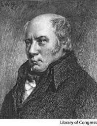
William “Strata” Smith
With the end of the Napoleonic wars, old 18th century prejudices against field work were beginning to fade and the heroic age of geology began. Smith, now happily pensioned off in retirement at Scarborough, came eventually to be acknowledged as the “father of English geology”. The study of Geology became the cutting-edge discipline of the field of science. In this era of new scientific knowledge geology caught the imagination of every educated man and woman, and, for this brief period, Geology occupied the slot in popular imagination that, say, molecular biology or fundamental physics does today. This was true all over Europe and North America, but in Great Britain – a compact country with good communications, increasing availability of detailed topographic maps, a good range of rocks and perhaps, above all, a wealthy middle class, was where much of the new advances at this time were made.
The heroes of the great age of geology were largely self-taught, often independently wealthy men. They had not completed courses in geology at university: there were none. They believed in application and intellectual rigor combined with getting out into the field to see for themselves. Following Smith, they believed that making a geological map was the best way to record their observations and work out their ideas.
Two of the greats of this time were Roderick Murchison and Adam Sedgwick. Before their arrival on the scene, all the easy bits of English geology – the regular, fossil-rich strata that succeeded, layer upon layer, from the Carboniferous up to the Cainozoic – had been essentially mapped by William Smith and published in his great 1815 map of England and Wales. But for Smith and other stratigraphers of the late 18th and early 19th century, the rocks lying below the Carboniferous (they were called Coal Measures at the time) were difficult – they contained few fossils, were metamorphosed to varying extent and much folded and faulted. Such rocks occupied the mountainous areas in the north and west of Great Britain and were lumped on contemporary maps into one grey, amorphous mass known as the Greywacke Series.
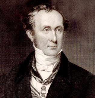
Sir Roderick Impey Murchison
Roderick Impey Murchison (1792-1871) was a Scottish Highland gentleman who, in his youth, had joined the army and fought in the Peninsula War against the French. On discharge, he married a rich heiress and took to country pursuits. After a few years, when killing foxes rather than Frenchmen began to pall, he had the good fortune to meet Charles Lyell. Lyall persuaded him to take up geology, by now a rapidly developing scientific craze. After apprenticeships in the easy rocks of the south of England, and the somewhat more complex rocks of the Alps, Murchison decided to tackle the outstanding problem of the day: the old greywacke series rocks that lay unconformably below the Coal Measures. As far as anyone then knew, these rocks could be the oldest on earth and contain its oldest fossils.
Murchison was a demon for field work – he climbed mountains, walked stream courses, covered hundreds of miles on foot, on horse or by coach. He started work in Shropshire on the border of England and Wales. In the Welsh borders, Coal Measures often sat unconformably on top of the greywacke series. He mapped the old rocks westwards into Wales, placing them in a new geological period which he called Silurian after a long-extinct Welsh tribe. Murchison’s major work “The Silurian System” was published in 1839.
Murchison went on to become the outstanding figure in 19th century British geology and geography: President of the Geological Society (now reformed from its early days as a dining club for rich, dilettante London snobs); Fellow of the Royal Society; Director General of the British Geological Survey; first President of the Royal Geographical Society.
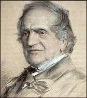
The Reverend Professor Adam Sedgwick
The Reverend Professor Adam Sedgwick did not set out to be a geologist either. He took a degree in Mathematics at Trinity College Cambridge (1808), and subsequently Holy Orders in the Church of England (1817). But in 1818, somewhat surprisingly – never having previously done any geology – he was appointed to the post of Woodwardian Professor of Geology at Cambridge University. As he himself said on his appointment: “up till now I have never turned a stone. Now I will leave no stone unturned.”
Sedgewick was as good as his word. An energetic and charismatic character, and apparently a brilliant lecturer (one of his students was Charles Darwin). He discovered in himself a passion and talent for field work. By 1830, having established his geological credentials, he too decided to apply himself to the problem of the greywacke series.
Starting in Central Wales, Sedgwick studied and mapped the hitherto intractable metamorphic rocks – calling them the Cambrian System – a name he coined from the old Roman term for Wales. He worked his way east towards England, mapping Cambrian Rocks as he went [2]. Somewhere in mid-Wales he passed Murchison, mapping his way west and calling all his rocks Silurian. Thus began the great Cambrian-Silurian controversy. Murchison argued that Sedgewick’s Cambrian should be seen as a sub-division of his Silurian System: Sedgewick argued the Silurian was a sub-division of his Cambrian System. The two men were polite to each other and even published a joint paper on the subject in 1835. But neither would concede. To the Reverend Sedgwick, the Cambrian contained the oldest rocks in the world (well, in Great Britain, at any rate, but in the 19th century British gentlemen often conflated the two) and so might contain evidentiary record of the Biblical Creation [3].
No frocked Anglican cleric would easily give up priority in such an area.
The controversy over the Cambrian-Silurian boundary was not resolved for over 40 years. The problem was that there were comparatively few fossils, and the geological maps of both Sedgwick and Murchison were too small-scale and interpretational to show relationships of units across wide areas of complexly deformed terrain.
The man who resolved the Cambrian-Silurian problem was another self-taught geologist – a Scottish English/History schoolteacher called Charles Lapworth (1842-1920). In his summer holidays, Lapworth virtually invented detailed large-scale outcrop mapping. He was able to do this because the Ordnance Survey of Great Britain was by now offering good land coverage of very detailed topographic maps at a scale of 6 inches to the mile (approximately 1:10,000). These provided ideal base for geological mapping – a resource not available to Murchison or Sedgwick (or William Smith, for that matter).
Working in this detailed way in the Southern Uplands of Scotland and using a finely graduated series of evolving graptolites as indicator fossils [4] occurring through a thin sequence of black shales, by 1879 Lapworth was able to show that a third major sequence could be placed between the Cambrian of Sedgwick and the Silurian of Murchison. He named this new Period the Ordovician, after yet another extinct Welsh tribe. The Ordovician was quickly adopted in Great Britain, but it was 1960 before the division was officially recognised by the International Commission of Stratigraphy.
Lapworth went on to become the foundation Professor of Geology at the University of Birmingham. Here he is in his professorial days :
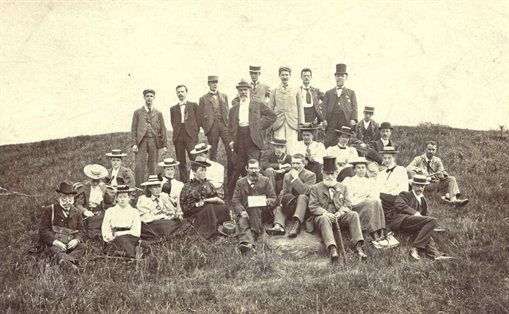
Charles Lapworth leads a party of geology students into the field. I think he is the top-hatted guy in front row. From the clothing (suits, waistcoats, ties, long skirts, stovepipe and boater hats) the date is probably early nineteen hundreds. He has a surprising number of female students.
In much of Wales and the Welsh borders where Murchison and Sedgwick worked, the Carboniferous lay unconformably on top of the Silurian. Elsewhere (particularly in the County of Devon), a conformable sequence of fossiliferous red sandstone (its local name was Old Red Sandstone) occurred between the two Formations. This led to another protracted controversy, which this time pitted Sedgwick and Murchison against another early great of geology – Henry De La Beche [5]. This controversy eventually led to the definition of the Devonian Period between the Silurian and the Carboniferous, thus completing the tally of the periods of the Paleozoic Era.
Except for the Permian.
By 1834, the Triassic (the first Period of the Mesozoic Era) had been named by German geologists, but the boundary between Triassic and Carboniferous rocks (each with dramatically different fossil assemblages) was still undefined because, through much of Britain and Europe, this important contact lay within sequences of non-fossiliferous red sandstone (the “New Red Sandstone“). Roderick Murchison solved this problem and, in so doing, defined the last and uppermost Period of the Paleozoic. In 1841, accompanied by the French paleontologist Eduard de Verneuil, Murchison visited Russia and examined a thick sedimentary sequence of fossil-bearing rocks overlying Carboniferous rocks along the River Klyaz’ma in the Perm district west of Moscow. From these observations he defined and named the Permian Period, the last subdivision of the Paleozoic Era.
You can read about the “Great Devonian Controversy” in the fascinating book of that name by Martin Rudwick (published 2008).
You can find more details of the Cambrian-Silurian dispute in “Controversy in Victorian Geology: The Cambrian-Silurian Dispute” by James E Secord (published 1990).
For Murchison’s travels in Russia see the paper by Michael Benton (and others) “Murchison’s First Sighting of the Permian at Vyazniki in 1841″ (Proceedings of the Geologists Association, 2010, p 313-318).
[1] For an excellent account of the travails of William Smith and his battle with the early geological establishment in the form of the Reverend George Greenough, the first president of the London Geological Society, I recommend “The Map that Shook the World” by Simon Winchester (Viking, 2001).
[2] Sedgewick took along with him as a field assistant a young student from Trinity College called Charles Darwin. I wonder what the Reverend Professor and the theology student talked about as they sipped their pints of an evening in some Welsh Inn after a hard day in the Hills?
[3] Adam Sedgewick remained a staunch biblical creationist all his life. Years later he was appalled when his former field hand published The Origin of Species.
[4] From the famous locality of Dobs Linn near Moffat in Scotland, now a geological heritage site and the stratotype for the Ordovician-Silurian Boundary.
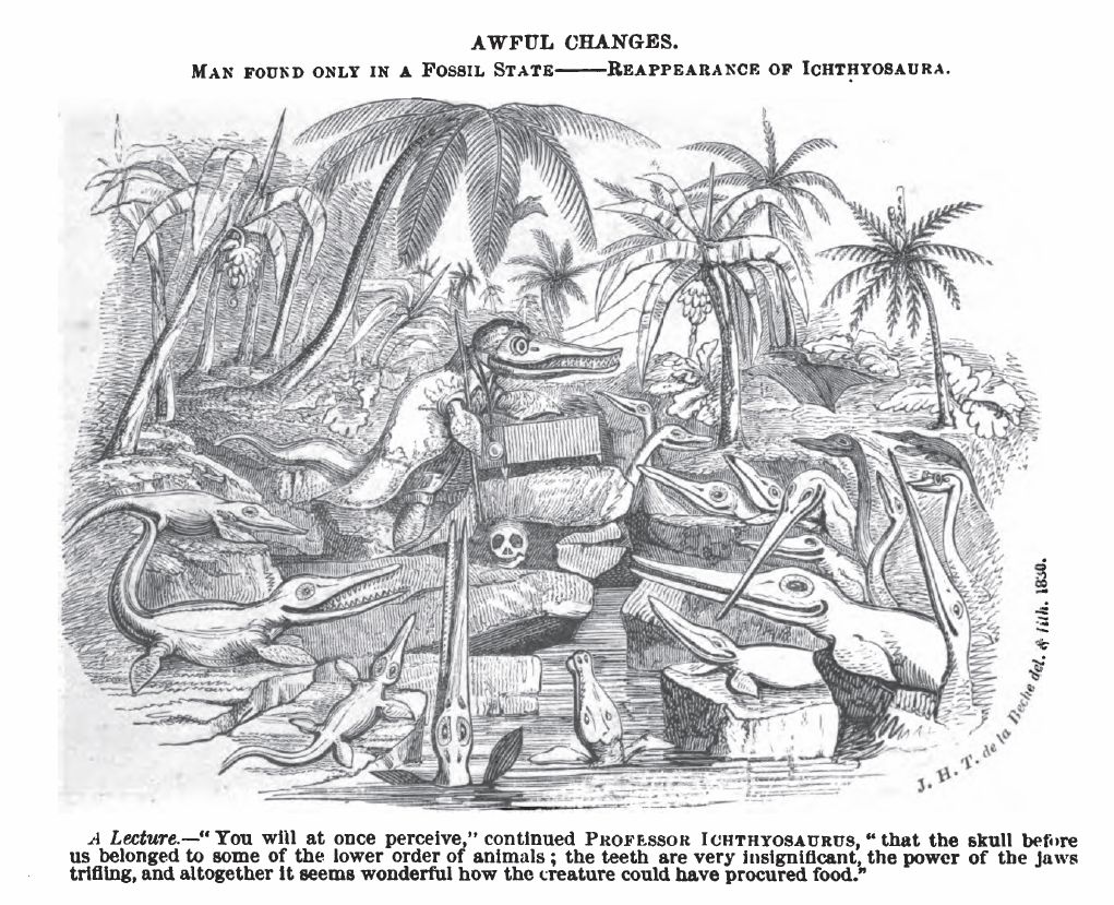
[5] De la Beche (1796-1855). Like Murchison, De La Beche was another ex-army man who had to find a new career after Waterloo. He became the first Director of the Geological Survey of Great Britain in 1835 (then called the Ordnance Geological Survey. It remained a division of the Ordnance Survey – the UK topographic mapping agency – until 1965). To my mind De La Beche is the most likeable of the early greats of geology. He had a sense of humour for a start, something which nobody, I suspect, ever accused Sir Roderick of. I reproduce one of De La Beche’s cartoons below. On top of that, he was interested in mining geology and tried his best to help the impoverished Lyme Regis fossil hunter Mary Anning, who found many of the fossils that De La Beche illustrates:
Pur si simplu perfect. The invention of the Palaeozoic